South Cumbria Rivers Trust are currently working on the Windermere Lake Action Plan to improve the key biodiversity/natural capital assets of the lake, its shore and the public benefits this provides, by identifying and implementing practical action. In order to do this, we are:
-
Reviewing existing information and carrying out vegetation surveys to establish a baseline of extent and current condition.
-
Comparing this with historic data to understand trends and highlight areas for concern.
-
Developing a pipeline of receptor sites that would benefit from restoration.
-
Seeking funding from appropriate sources to implement creation / restoration of target habitats.
We are currently undertaking vegetation surveys of the Hydrosere zone in the North basin of Lake Windermere. Hydrosere is a plant succession originating from a water body and we are looking at what plants are within this succession, from aquatic to terrestrial. The last set of hydrosere vegetation data was collected in 1978 and it is therefore likely that changes in vegetation structure have occurred over the last 40 years. The survey and species data we collect will allow us to gain an insight into the current condition of the hydrosere and how these areas have changed since 1978. Comparisons of the data will allow us to pinpoint areas that are degrading, or those that have been unaffected, by increasing threats such as increased boat traffic and lake shore development. By looking at these sites in more detail we will also be identifying areas to conduct restoration work or projects to improve hydrosere and reedbed habitat.
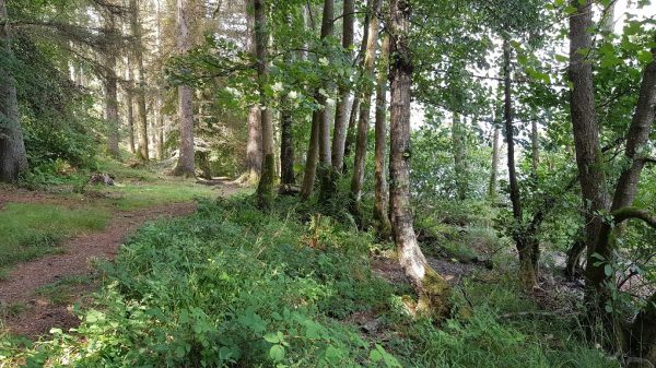
Figure 1: Windermere Hydrosere